

In Search of a “Buaile”

Moonacoon House, Knocknascrow, Galtee Mountains
Buaile (Irish)
Booley (English)
8th January 2023
Into the West
In my ramblings in the Galtees in the past couple of years, I had never actually been to the westernmost end of the range. I hadn’t yet climbed Temple Hill, the ominous-looking conical peak which stands alone beside Lyracappul. I start most of my hikes from the Cush carpark, or the Galtymore North carpark, both of which are short drives from home. On the odd occasion I go around the range to launch from the southside, I generally access the same central peaks from either the Black Road or King’s Yard. That’s why, last Sunday, I decided to head to the village of Anglesborough (a 20 minute drive), to approach the range from a new angle.
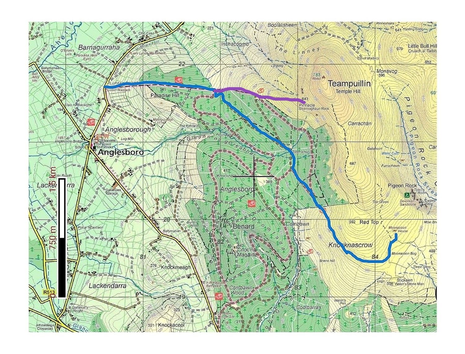
I had plotted my route the night before. I would park the car near Anglesborough and follow signs for the Paradise Hill Loop for the first 3 kilometres or so, before ultimately veering off track through a short stretch of forest to enter the open mountain.

Upon exiting the forest, I would avoid too much strain by contouring around Red Top at about 500 metres. I would do my best to hold this elevation. If I unconciously descended as I circled around the small hill, I may have to reascend later. My main destination, Moonacoon House, was at about 530 metres. You can see it on the bottom right of the map below, at the end of the blue trail which marks my route.

Zoomed-in screenshot taken from the EastWest map of the Galtees, with my route shown in blue.
The Booley House
It may be too small to see on the map above, but there is a symbol of a brown cow under the name “Moonacoon House”. I learned during a Mountain Skills course last year that the cow identifies a Booley site. Booleying is something I’ve touched upon before in my blog post about Achill Island, but it was only when taking the MS1 course that I discovered there are quite a few Booley sites in the Galtees, and that they are marked on the brilliant EastWest map.
Indeed, the one in Knocknascrow (pictured at the top of this page) is also pictured in this RTE article about booleying:
The Lost Art of 'Booleying' in Ireland by Eugene Costello (UCC)
If you haven’t got the time to read the full article, Eugene Costello describes booleying as a process undertaken by “families that owned cattle, usually dairy cows, and their goal was to take advantage of the seasonal burst of grass growth that takes place in upland areas from May onwards.” Quite literally, certain family members would move into the hills from May through the summer and graze cattle there, living in a Booley house on the hillside for that time, before returning to the homestead in September or October. Driving cattle out of the lowland farm and into the hills during the summer months meant that the land back home could be used for crops and making hay.
One thing that surprised me in the above article was the fact that it was often young people, and particularly young girls, who were given the job of looking after the cows in these hillside boolies. Eugene Costello writes that the lyrics of some songs and folk tales suggest this may have been the greatest period of freedom in some women’s lives, and that some may have pined for those days in later years when they had settled into family life. The idea that Boolies might have been hubs for socialising far beyond the watchful eyes of home, hadn’t really occured to me before. I had always imagined life in the hills as being dreary and full of hardship. While I’m sure there was hardship, I can see now that I was simplifying the past and making the classic mistake of thinking everything in “old Ireland” was backward and we’re now much more forward-thinking.
Since reading this article, I’ve bought an e-book version of Costello’s book Transhumance and the Making of Ireland's Uplands, 1550-1900, which explores the history of booleying in Ireland. There is a chapter specifically dedicated to the Galtee mountains. I will certainly be reporting back on my reading of this, and other historical sources, in future blog posts.
Temple Hill
One thing I hadn’t quite decided before setting off, was whether or not I would go up Temple Hill after visiting the Booley. Reading the map, it did appear that the climb was more gradual from the south side. Temple Hill is renowned as a leg burner, with a lot of elevation gain over a short distance. In that sense I would be in the perfect position to veer north from Moonacoon House, taking advantage of a slightly easier route and summiting the peak for the first time.
The potential complications were obvious. Firstly, the days are short in winter. Depending on how much time I spent at the Booley (and other scenes which I may decide to photograph), I could run out of daylight. I had left the car just after 9am, so I hadn’t exactly started at the crack of dawn. And my photographic process is slow and methodical.
Not to mention the weather conditions could turn. The weather was dry but overcast in the early part of my walk, but higher up things can be very different, and there was a gloom hanging over the upper reaches. I would play it by ear.
The Scene
When I arrived at the Booley, I told myself I should take a rest, have some food and water, before taking out the camera. Sitting to eat and drink would allow me time to analyse the scene and decide how best to approach it. I laid down my bags inside the walls and sat down in a corner of the ruined building to shelter from the wind.
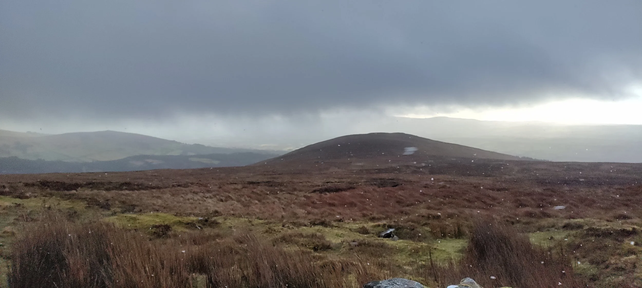
I had just taken a few sups of water when I began to feel a bite in the air. A greyness had descended and the air seemed to have turned colder quite suddenly. I treated myself to an apple and a flapjack, before I could no longer leave my naked fingers exposed - back on with the gloves, and fast! After a few moments, I could see light snowflakes falling around me. Apologies for the terrible picture, but you can get a sense of it in the picture below.
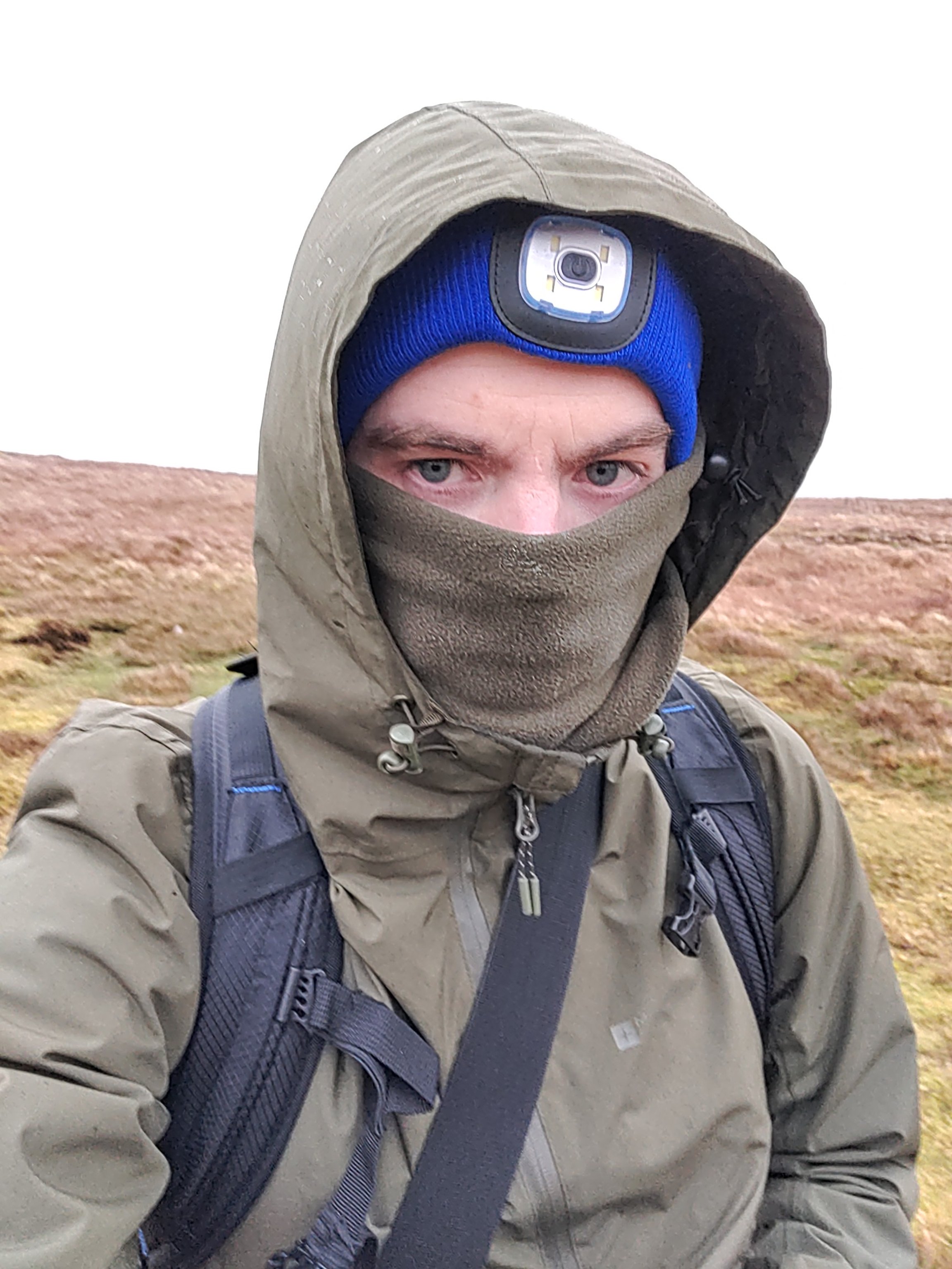
I took a moment to embrace the uniqueness of the situation. Shielding myself from the cold wind and falling snow behind the Booley wall, I felt admiration for the crumbling wall for still serving its purpose centuries after it was constructed. I couldn’t dawdle for long though, as the cold temperatures spurred me back into the task at hand. I put on plenty of extra layers - gloves, jacket, snood (the terrorist look, as you can see in the image below) - and began to circle the house with my camera and tripod at the ready.
The coldness was making it difficult for me to spend much time in one position. It rushed my process, which made it harder for me to focus on composing an interesting photograph (to be honest, I didn’t really get a photo I was genuinely happy with - I might have to come back). Each time I had a composition ready in the viewfinder, I had to remove a glove to turn the focus wheel and push the shutter button. The cold darted through my fingers into the rest of my body any time I had to touch the metal and plastic of the camera and lens.
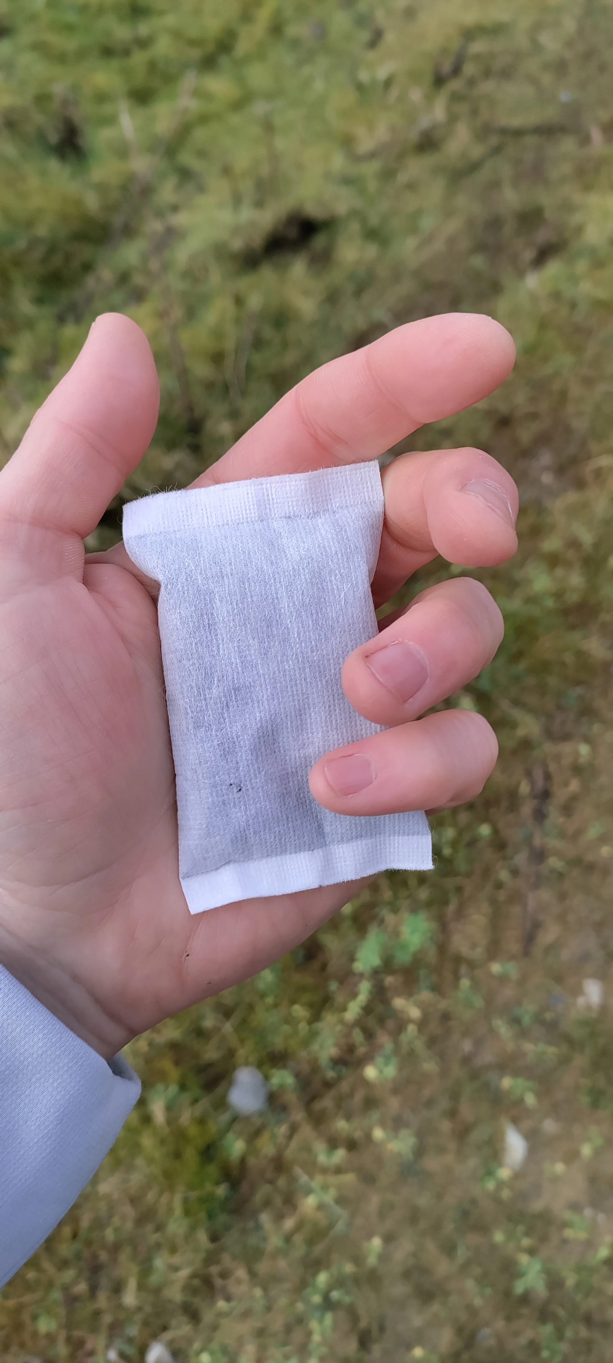
After a few rounds of this, simply putting the gloves back on wasn’t enough to restore any kind of heat into my numb fingers, and I needed to stop fiddling with the camera for a time. It was time to open a packet of hand warmers. I put the camera back into its bag and shuffled back into the booley house, crouching in the same corner again. If you haven’t used hand warmers before, they are activated when air hits them and begin to emit heat after a few moments of exposure. You can see one of them pictured on the left above - they almost look like tea bags. Once the hand warmers had generated enough heat, I held one tightly in each fist and put on the gloves again. I then buried my hands into my jacket pockets and sat slumped in the corner, patiently waiting for the heat to radiate through my body. It took longer than I expected for this to take effect, but in time they did the job. I had at least restored some feeling in my fingers.
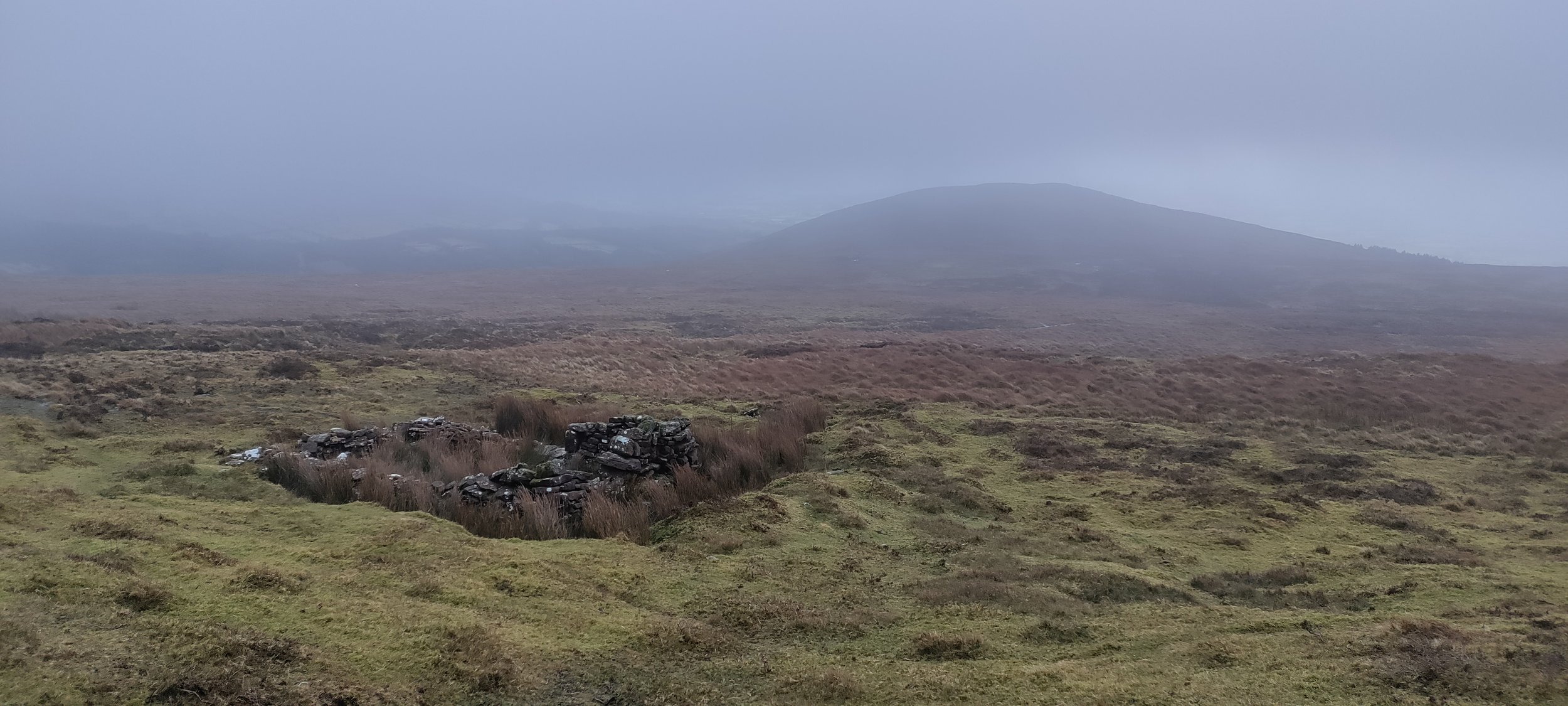
Image of Moonacoon House taken on my phone
Thankfully, I was able to return to photography at this point, only removing a glove when absolutely necessary. Having tried a few different vantage points from which to photograph the house, a nearby stream caught my eye. It looked like it might be run-off water, rather than any kind of marked stream, because it didn’t seem to follow through on its course (yet the map does show a marked stream). It sort of disappeared after a few metres, as you can see in the image below.

A marked stream near Moonacoon House
Temple Hill was not really an option, as it turned out. The weather looked bleak above me, and a quick Google search told me it was very windy up there. Time was pushing on too. These overcast days don’t exactly entice you into summiting a mountain anyway. It’s not as if you’re going to have amazing views at the top. So, I retraced my steps around Red Top. On the way back down, the temperatures rose again and the sun even poked its head out a couple of times. Rather than contouring all the way around the hill again, I swung off to the west a little this time, descending to about 400m. There was a second booley site marked on the map and I would visit it on my way home. See the icon circled in red in the map below.

Zoomed-in screenshot taken from the EastWest map of the Galtees, with the second booley site marked in red.
When I arrived there, I found a structure in a roughly similar condition to Moonacoon House, although more overtaken by grasses. Its surrounding landscape wasn’t quite as dramatic, being at a slightly lower altitude and quite close to a forested area.

Second Booley Site at a lower altitude.
21st January 2023
Two weeks later…..
Temple Hill - Part II
I had to come back. To have been in and around the intimidating peak and not have gone all the way up - it was gnawing at me. So, two Saturdays later, I was parked up in the same spot again, just outside Anglesborough.
As I crouched to tie the laces on my hiking boots, a muddy jeep slowed on the road beside me, winding its window down. The first creature to greet me was a beautiful sheepdog, stretching himself out the passenger window and flicking his head in excitement. Behind the dog, a local farmer looked at me with curiosity.
“Are ya alright?” he asked.
“Yeah , all good.”
“Have ya a puncture?”
“No, I’m just putting on the hiking boots is all.” I raised a foot to show him.
“Are ya goin up the hill?”
“Hopefully, yeah! Depending on how the weather plays out. It’s looking a bit bleak up there at the moment.”
The old man leaned across to have a look at the mountain, his face not giving much away.
“Sure I can always turn back,” I reassured him. “We’ll see how we go.”
“Alright so,” he announced, and put the jeep in gear.
My options were to follow the same route as last time, approaching Temple Hill through the back door - a longer but easier climb - or to take the more direct and more vertical route. I decided to take the more direct route - something new. See the purple strip on the map below for the difference in route this time around.
You may notice a spoiler here…. Have you spotted it? I know, I know…. I’m as annoyed as you about it, but more on that in a minute!
Direct route up Temple Hill (purple marking)
It’s clearly a steep climb, more or less from start to finish. As you can see on the map, there’s quite a bit of elevation gain over a short distance. Nevertheless, I was fairly content with my progress up the hill. I certainly wasn’t ambling! The granola and coffee I had started the day with was doing its work. I had a mission, and the camera wouldn’t come out in earnest until I was up there, until views began to emerge….

The Paradise Hill Loop Path
“Views”, eh? Well, there’s the rub. Even at the car it was an overcast day, so the likelihood of having any kind of view on Temple Hill was slim, unless things drastically changed. As I advanced up the hill, the wind was gradually picking up, but certainly nothing to worry about. I was shielded by a wooded area for the first two kilometres or so. It was only upon leaving this shelter (at about 500 metres), and following an exposed trail up the hill (the latter half of the purple strip), that the breeze became more noticeable. Even so, it didn’t strike me as anything out of the ordinary at that stage.
There were two people about 100 metres ahead of me when I left the woodland’s edge, but I seemed to be gaining on them. As I got closer to them, I began to realise why they were stopping so regularly - the wind had picked up considerably. When I caught up with them - two men - we chatted for a moment.
“It’s punishing enough, isn’t it?” I said, having to force my voice over the wind.
They told me it was their first hike in a while, so they were struggling a bit, but they had been up this hill a number of times in the past (unlike me!). I drew on their experience.
“What’s it going to be like up there?” I asked.
“You won’t be able to use that,” one of the men said, nodding towards my camera bag.
“I thought as much,” I said. “It’s the wind I’m worried about.”
I wished them all the best and pressed on. Generally, when you say your goodbyes to fellow hikers, the implication is that you’re pushing on ahead, you’re moving that bit quicker (in this case by virtue of being a solo traveler), so you likely won’t meet again, bar maybe on the way back. This proved not to be the case…
When I reached a particularly exposed “shoulder” (this may not be the correct term - I’m still struggling to get a grip on mountain terminology), the wind really picked up and was driving into my side from the west. I stepped down off the trail slightly (which was near an edge), and cushioned myself into the western side of the slope, so that at worst the wind would push me into the side of the slope. I used this opportunity to crouch for a moment and check my phone. I checked the weather on Temple Hill on Google. The wind speeds were due to pick up even more in the next hour. Given how windy it was at this elevation, I didn’t think it boded particularly well for the summit, probably 200 metres higher than where I sat at that moment.
One of the two chaps I had spoken to earlier caught up with me and, as he passed me by, I gestured for him to come towards me. The only way you could communicate was by being right next to one another, such was the howling wind.
“Google says it’s only going to get worse,” I told him, projecting my voice as much as I could, “and the summit is about 200 metres higher.”
“Are you calling it?” he shouted back.
“I think so.” We looked back at the second man, about to reach us. When he arrived we filled him in on our conversation.
“Imagine what it’ll be like up there,” said the second man, panting from the exertion of the climb.
The first man maintained that this part was the worst stretch, as we were totally exposed, but perhaps we could get as far as Shannaghaun Rock (or “the Pinnacle”). There we could dip behind the outcrop for some shelter from the wind and evaluate things. Though I was almost certain that I was turning back, I agreed to go as far as the rock as it was only a little further and it would feel like a more natural stopping point.
Thankfully, there was some relief from the wind. I had a quick bite to eat and some water. I chatted briefly with the two men, but the wind still forbade any kind of meaningful conversation. What was clear was that we were all going back. The guys told me we were actually over the worst of it in terms of climbing, and the remainder is usually not so bad. That didn’t do much to quell the anti-climactic feeling in me.
After some hesitation, it was time. Though it’s always disappointing to turn back, I do also feel a kind of quiet satisfaction in knowing I’ve made the right decision. There will be other days.
Once I had descended past the particularly exposed stretch just below the rock, I made swift progress. I was half trotting some of the descent, in fact. The unfinished hike gave me a sense of having energy still in reserve. Any self-congratulating ideas I might have had about being a mountain goat trotting down the mountain were dashed when a trail runner whizzed past me in his shorts and t-shirt. I got a fright! I hadn’t heard him approaching with the wind clattering against the outside of my hood. Had he come down from Temple Hill, then? Some people just operate differently.

Looking back down along the fence that leads towards Temple Hill.
I’m not having good luck with the weather at the moment. There have been an awful lot of crisp, bright weekdays when I’ve been in the office, but the weekends seem to be getting the dreary weather. It’s a shame, but there will be a Part Three. I’ll ensure there’s pictorial evidence too, don’t worry! Bloody hell, what a saga…
I think it’s important to say that I’m not particularly interested in “bagging” peaks. That’s to say, just getting to the summit and ticking it off the list doesn’t really do it for me. I would much prefer to be able to experience the place, do some photography, or even just spend some time up there. In wild weather, reaching the summit of a mountain tends to be a much shorter experience, with less time for soaking it in. I’ve done this on Galtymore in the past, and you’re left wondering why you bothered. I’m not out there trying to be Tom Crean on some feat of endurance. I want to enjoy the experience, and while there is certainly an interesting experience in being battered by the wind on a mountain, in that context it probably could be any mountain…
Plans for February
In my reading of Eugene Costello’s Transhumance and the Making of Ireland's Uplands, 1550-1900, I came across a reference to a place I believe I’ve passed before. Earlier in this piece I wrote about my learning that the cow symbolised a Booley site during a Mountain Skills course. This arose on Day 1 of the course. We started our day at King’s Yard on the southern side of the Galtees and ultimately did a sort of a loop across the day. On the back end of our route, about 2.5km north-northwest of King’s Yard, we passed some ruined houses and enclosures. These ruins are mentioned (and pictured, as you’ll see in the screenshot below) in Costello’s book. Lying as it does at a lower altitude, this location is doable even in dodgy weather. So that’s certainly on the agenda for February.

Screenshot from a page in Eugene Costello’s book on Booleying
And of course…. You know it. I know it. Temple Hill will be revisited.
When I inevitably go back for a third (and what better be a successful!) try at this ever-windy mountain, I’m planning to incorporate another stop into it. I’ve noted another Booley site southeast of Temple Hill, near some water cuts. My plan is to summit the peak the direct way, but then descend down the southside and veer east off the slope to visit this marked site. From there I can contour back around towards Moonacoon House and, depending on the time of day and the weather conditions on the day, I might even get some new pictures there that I’m a bit happier with. These agricultural sites really interest me, and I’m really enjoying the research that goes with visiting them.
Thank you for Reading!
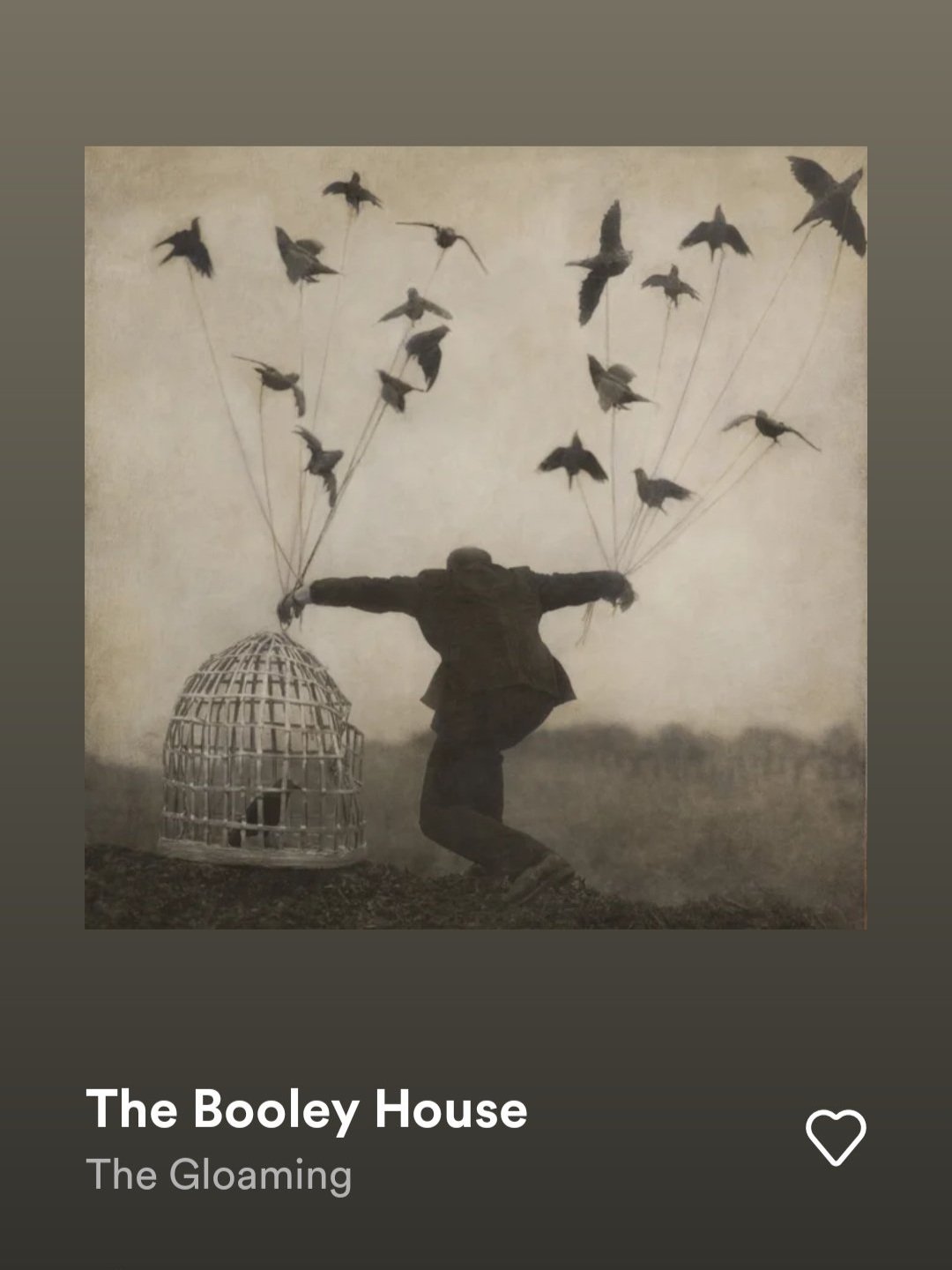
As a quick aside, there’s a song I like called “The Booley House”. It’s a song by The Gloaming, one of my favourite groups in recent years. They produce a brand of traditional Irish music with a slightly modern take. “The Booley House” always struck me as unusually breezy, a kind of easygoing tune, and that sort of jarred with my idea of rural hardship. With a fresh perspective on the social fabric of communities who engaged in these practices, the song’s gently undulating melodies make more sense to me. Have a listen with a cup of tea, if you’ve got a moment.
All the best!
Alan
Never miss a blog post! Subscribe to my mailing list and have it come straight to your inbox.